|
| at: |
Talladega National Forest |
Data from USFS GIS
 show on map
 animate
Trail users:


Elevation Profile
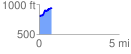
 0.779728 mi
 181.93 ft
 77.22 ft
 104.71 ft
 4.42 %
GPX Downloads: Track Route
![]()
|
| at: |
Talladega National Forest |
show on map
animate
0.779728 mi
181.93 ft
77.22 ft
104.71 ft
4.42 %