|
| at: |
Talladega National Forest |
Data from USFS GIS
 show on map
 animate
Trail users:


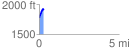
Elevation Profile
 0.269024 mi
 156.35 ft
 16.97 ft
 139.38 ft
 11.01 %
GPX Downloads: Track Route
![]()
|
| at: |
Talladega National Forest |
show on map
animate
0.269024 mi
156.35 ft
16.97 ft
139.38 ft
11.01 %