|
| at: |
Talladega National Forest |
Data from USFS GIS
 show on map
 animate
Trail users:


Elevation Profile
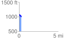
 0.295092 mi
 65.08 ft
 97.44 ft
 -32.36 ft
 6.25 %
GPX Downloads: Track Route
![]()
|
| at: |
Talladega National Forest |
show on map
animate
0.295092 mi
65.08 ft
97.44 ft
-32.36 ft
6.25 %