|
| at: |
Talladega National Forest |
Data from USFS GIS
 show on map
 animate
Trail users:


Elevation Profile
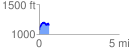
 0.603084 mi
 171.26 ft
 93.49 ft
 77.77 ft
 5.38 %
GPX Downloads: Track Route
![]()
|
| at: |
Talladega National Forest |
show on map
animate
0.603084 mi
171.26 ft
93.49 ft
77.77 ft
5.38 %