|
| at: |
Talladega National Forest |
Data from USFS GIS
 show on map
 animate
Trail users:


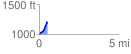
Elevation Profile
 0.519514 mi
 204.27 ft
 0.00 ft
 204.27 ft
 7.45 %
GPX Downloads: Track Route
![]()
|
| at: |
Talladega National Forest |
show on map
animate
0.519514 mi
204.27 ft
0.00 ft
204.27 ft
7.45 %