|
| at: |
Talladega National Forest |
Data from USFS GIS
 show on map
 animate
Trail users:


Elevation Profile
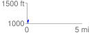
 0.163862 mi
 49.41 ft
 13.65 ft
 35.76 ft
 5.71 %
GPX Downloads: Track Route
![]()
|
| at: |
Talladega National Forest |
show on map
animate
0.163862 mi
49.41 ft
13.65 ft
35.76 ft
5.71 %