|
| at: |
Talladega National Forest |
Data from USFS GIS
 show on map
 animate
Trail users:


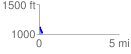
Elevation Profile
 0.243806 mi
 20.07 ft
 119.43 ft
 -99.36 ft
 9.28 %
GPX Downloads: Track Route
![]()
|
| at: |
Talladega National Forest |
show on map
animate
0.243806 mi
20.07 ft
119.43 ft
-99.36 ft
9.28 %