| at: |
Seminole State Forest |
Data from Karlos Bernart
 show on map
 animate
Trail users:


Elevation Profile
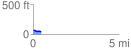
 0.496630 mi
 3.51 ft
 28.65 ft
 -25.14 ft
 1.09 %
GPX Downloads: Track Route
![]()
| at: |
Seminole State Forest |
show on map
animate
0.496630 mi
3.51 ft
28.65 ft
-25.14 ft
1.09 %