| at: |
Ocala National Forest |
Data from Karlos Bernart
 show on map
 animate
This road is notorious for long, loose sand pits.
Trail users:


Elevation Profile
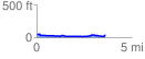
 3.608496 mi
 72.11 ft
 86.38 ft
 -14.27 ft
 0.45 %
GPX Downloads: Track Route