| at: |
Richloam/Green Swamp WMA |
Data from Karlos Bernart
 show on map
 animate
Trail users:


Elevation Profile
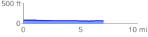
 7.015444 mi
 22.68 ft
 34.19 ft
 -11.51 ft
 0.09 %
GPX Downloads: Track Route
![]()
| at: |
Richloam/Green Swamp WMA |
show on map
animate
7.015444 mi
22.68 ft
34.19 ft
-11.51 ft
0.09 %