| at: |
Iron Legs |
Data from David Muse
 show on map
 animate
This trail is fairly overgrown. It looks like people just miss the sign for it on the way out.
Trail users:

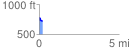
Elevation Profile
 0.245867 mi
 10.55 ft
 56.91 ft
 -46.35 ft
 4.38 %
GPX Downloads: Track Route