| at: |
Iron Legs |
Data from David Muse
 show on map
 animate
Trail users:


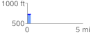
Elevation Profile
 0.319905 mi
 25.36 ft
 10.30 ft
 15.06 ft
 1.50 %
GPX Downloads: Track Route
![]()
| at: |
Iron Legs |
show on map
animate
0.319905 mi
25.36 ft
10.30 ft
15.06 ft
1.50 %