| at: |
Iron Legs |
Data from David Muse
 show on map
 animate
Trail users:


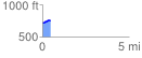
Elevation Profile
 0.475920 mi
 43.08 ft
 1.51 ft
 41.57 ft
 1.71 %
GPX Downloads: Track Route
![]()
| at: |
Iron Legs |
show on map
animate
0.475920 mi
43.08 ft
1.51 ft
41.57 ft
1.71 %