| at: |
Sope Creek/Cochrans Shoals |
Data from David Muse
 show on map
 animate
Trail users:


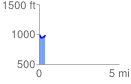
Elevation Profile
 0.387525 mi
 54.97 ft
 65.55 ft
 -10.58 ft
 3.20 %
GPX Downloads: Track Route
Trailheads:
 Paper Mill Road
![]()
| at: |
Sope Creek/Cochrans Shoals |
show on map
animate
0.387525 mi
54.97 ft
65.55 ft
-10.58 ft
3.20 %
Paper Mill Road