| at: |
Sope Creek/Cochrans Shoals |
Data from David Muse
 show on map
 animate
Trail users:


Elevation Profile
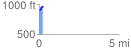
 0.220907 mi
 73.23 ft
 13.88 ft
 59.35 ft
 6.28 %
GPX Downloads: Track Route
![]()
| at: |
Sope Creek/Cochrans Shoals |
show on map
animate
0.220907 mi
73.23 ft
13.88 ft
59.35 ft
6.28 %