| at: |
Sope Creek/Cochrans Shoals |
Data from David Muse
 show on map
 animate
Trail users:

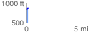
Elevation Profile
 0.122812 mi
 51.98 ft
 0.00 ft
 51.98 ft
 8.02 %
GPX Downloads: Track Route
![]()
| at: |
Sope Creek/Cochrans Shoals |
show on map
animate
0.122812 mi
51.98 ft
0.00 ft
51.98 ft
8.02 %