| at: |
Flying Eagle Preserve |
Data from Karlos Bernart
 show on map
 animate
Trail users:


Elevation Profile
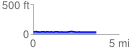
 3.702198 mi
 64.42 ft
 64.65 ft
 -0.24 ft
 0.33 %
GPX Downloads: Track Route
![]()
| at: |
Flying Eagle Preserve |
show on map
animate
3.702198 mi
64.42 ft
64.65 ft
-0.24 ft
0.33 %