| at: |
Pinelog WMA |
Data from David Muse
 show on map
 animate
This road follows the old railbed of the Iron Belt Railroad that connected the Sugar Hill iron mine with the Western and Atlantic Railroad near Cartersville.
Trail users:


Elevation Profile
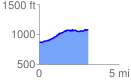
 3.061648 mi
 334.79 ft
 118.07 ft
 216.72 ft
 2.07 %
GPX Downloads: Track Route