| at: |
Bremen and Carrollton Area Roads |
Data from Georgia DOT
 show on map
 animate
Trail users:


Elevation Profile
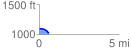
 0.640158 mi
 0.68 ft
 75.25 ft
 -74.57 ft
 2.23 %
GPX Downloads: Track Route
![]()
| at: |
Bremen and Carrollton Area Roads |
show on map
animate
0.640158 mi
0.68 ft
75.25 ft
-74.57 ft
2.23 %