| at: |
Pinelog WMA |
Data from David Muse
 show on map
 animate
Closed to vehicles in 2019.
Until late-2017/early-2018, the Main Road ran from Stamp Creek Road to Donahue Road, included the ungated section of Donahue Road, and then finally terminated with this (very badly rutted) section of road.
It was closed to vehicles in 2019 and has since become singletrack.


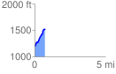
Elevation Profile
 0.737064 mi
 338.15 ft
 11.45 ft
 326.69 ft
 8.69 %
GPX Downloads: Track Route