| at: |
Tombigbee National Forest - South |
Data from USFS GIS
 show on map
 animate
Trail users:


Elevation Profile
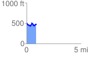
 0.880073 mi
 174.05 ft
 191.97 ft
 -17.92 ft
 4.13 %
GPX Downloads: Track Route
![]()
| at: |
Tombigbee National Forest - South |
show on map
animate
0.880073 mi
174.05 ft
191.97 ft
-17.92 ft
4.13 %