| at: |
Tombigbee National Forest - South |
Data from USFS GIS
 show on map
 animate
Trail users:


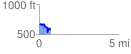
Elevation Profile
 0.700102 mi
 116.71 ft
 201.97 ft
 -85.26 ft
 5.46 %
GPX Downloads: Track Route
![]()
| at: |
Tombigbee National Forest - South |
show on map
animate
0.700102 mi
116.71 ft
201.97 ft
-85.26 ft
5.46 %