| at: |
Tombigbee National Forest - South |
Data from USFS GIS
 show on map
 animate
Trail users:


Elevation Profile
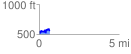
 0.656632 mi
 138.53 ft
 131.85 ft
 6.68 ft
 4.00 %
GPX Downloads: Track Route
![]()
| at: |
Tombigbee National Forest - South |
show on map
animate
0.656632 mi
138.53 ft
131.85 ft
6.68 ft
4.00 %