| at: |
Tombigbee National Forest - South |
Data from USFS GIS
 show on map
 animate
Trail users:


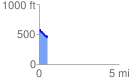
Elevation Profile
 0.533684 mi
 57.46 ft
 152.91 ft
 -95.45 ft
 5.43 %
GPX Downloads: Track Route
![]()
| at: |
Tombigbee National Forest - South |
show on map
animate
0.533684 mi
57.46 ft
152.91 ft
-95.45 ft
5.43 %