| at: |
Tombigbee National Forest - South |
Data from USFS GIS
 show on map
 animate
Trail users:


Elevation Profile
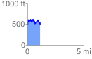
 1.137551 mi
 393.72 ft
 394.68 ft
 -0.97 ft
 6.57 %
GPX Downloads: Track Route
![]()
| at: |
Tombigbee National Forest - South |
show on map
animate
1.137551 mi
393.72 ft
394.68 ft
-0.97 ft
6.57 %