| at: |
Tombigbee National Forest - North |
Data from USFS GIS
 show on map
 animate
Trail users:


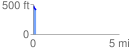
Elevation Profile
 0.177757 mi
 0.00 ft
 70.36 ft
 -70.36 ft
 7.50 %
GPX Downloads: Track Route
![]()
| at: |
Tombigbee National Forest - North |
show on map
animate
0.177757 mi
0.00 ft
70.36 ft
-70.36 ft
7.50 %