| at: |
Holly Springs National Forest - North |
Data from USFS GIS
 show on map
 animate
Trail users:


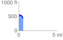
Elevation Profile
 0.550304 mi
 54.12 ft
 172.83 ft
 -118.71 ft
 5.95 %
GPX Downloads: Track Route
![]()
| at: |
Holly Springs National Forest - North |
show on map
animate
0.550304 mi
54.12 ft
172.83 ft
-118.71 ft
5.95 %