| at: |
Holly Springs National Forest - North |
Data from USFS GIS
 show on map
 animate
Trail users:


Elevation Profile
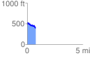
 0.765481 mi
 126.64 ft
 209.21 ft
 -82.57 ft
 5.18 %
GPX Downloads: Track Route
![]()
| at: |
Holly Springs National Forest - North |
show on map
animate
0.765481 mi
126.64 ft
209.21 ft
-82.57 ft
5.18 %