| at: |
Holly Springs National Forest - North |
Data from USFS GIS
 show on map
 animate
Trail users:


Elevation Profile
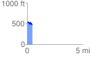
 0.459043 mi
 53.33 ft
 114.91 ft
 -61.58 ft
 4.74 %
GPX Downloads: Track Route
![]()
| at: |
Holly Springs National Forest - North |
show on map
animate
0.459043 mi
53.33 ft
114.91 ft
-61.58 ft
4.74 %