|
| at: |
Holly Springs National Forest - North |
Data from USFS GIS
 show on map
 animate
Trail users:


Elevation Profile
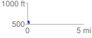
 0.152078 mi
 17.66 ft
 62.85 ft
 -45.19 ft
 7.83 %
GPX Downloads: Track Route
![]()
|
| at: |
Holly Springs National Forest - North |
show on map
animate
0.152078 mi
17.66 ft
62.85 ft
-45.19 ft
7.83 %