| at: |
Holly Springs National Forest - North |
Data from USFS GIS
 show on map
 animate
Trail users:


Elevation Profile
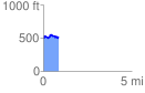
 0.866841 mi
 138.34 ft
 109.33 ft
 29.01 ft
 3.02 %
GPX Downloads: Track Route
![]()
| at: |
Holly Springs National Forest - North |
show on map
animate
0.866841 mi
138.34 ft
109.33 ft
29.01 ft
3.02 %