|
| at: |
Delta National Forest |
Data from USFS GIS
 show on map
 animate
Trail users:


Elevation Profile
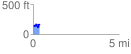
 0.362072 mi
 94.36 ft
 71.35 ft
 23.01 ft
 4.94 %
GPX Downloads: Track Route
![]()
|
| at: |
Delta National Forest |
show on map
animate
0.362072 mi
94.36 ft
71.35 ft
23.01 ft
4.94 %