|
| at: |
Bienville National Forest |
Data from USFS GIS
 show on map
 animate
Trail users:


Elevation Profile
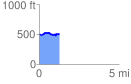
 1.255733 mi
 118.29 ft
 115.06 ft
 3.23 ft
 1.78 %
GPX Downloads: Track Route
![]()
|
| at: |
Bienville National Forest |
show on map
animate
1.255733 mi
118.29 ft
115.06 ft
3.23 ft
1.78 %