| at: |
Bienville National Forest |
Data from USFS GIS
 show on map
 animate
Trail users:


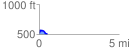
Elevation Profile
 0.547593 mi
 68.75 ft
 73.81 ft
 -5.06 ft
 2.55 %
GPX Downloads: Track Route
![]()
| at: |
Bienville National Forest |
show on map
animate
0.547593 mi
68.75 ft
73.81 ft
-5.06 ft
2.55 %