|
| at: |
Bienville National Forest |
Data from USFS GIS
 show on map
 animate
Trail users:


Elevation Profile
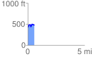
 0.588701 mi
 129.32 ft
 97.39 ft
 31.93 ft
 4.16 %
GPX Downloads: Track Route
![]()
|
| at: |
Bienville National Forest |
show on map
animate
0.588701 mi
129.32 ft
97.39 ft
31.93 ft
4.16 %