|
| at: |
Bienville National Forest |
Data from USFS GIS
 show on map
 animate
Trail users:


Elevation Profile
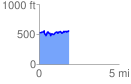
 1.870459 mi
 284.41 ft
 260.13 ft
 24.27 ft
 2.88 %
GPX Downloads: Track Route
![]()
|
| at: |
Bienville National Forest |
show on map
animate
1.870459 mi
284.41 ft
260.13 ft
24.27 ft
2.88 %