|
| at: |
Bienville National Forest |
Data from USFS GIS
 show on map
 animate
Trail users:


Elevation Profile
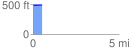
 0.533792 mi
 6.67 ft
 0.00 ft
 6.67 ft
 0.24 %
GPX Downloads: Track Route
![]()
|
| at: |
Bienville National Forest |
show on map
animate
0.533792 mi
6.67 ft
0.00 ft
6.67 ft
0.24 %