|
| at: |
Bienville National Forest |
Data from USFS GIS
 show on map
 animate
Trail users:


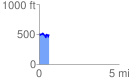
Elevation Profile
 0.610807 mi
 132.45 ft
 128.37 ft
 4.08 ft
 4.11 %
GPX Downloads: Track Route
![]()
|
| at: |
Bienville National Forest |
show on map
animate
0.610807 mi
132.45 ft
128.37 ft
4.08 ft
4.11 %