|
| at: |
Bienville National Forest |
Data from USFS GIS
 show on map
 animate
Trail users:


Elevation Profile
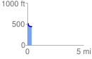
 0.374684 mi
 18.17 ft
 87.31 ft
 -69.14 ft
 4.41 %
GPX Downloads: Track Route
![]()
|
| at: |
Bienville National Forest |
show on map
animate
0.374684 mi
18.17 ft
87.31 ft
-69.14 ft
4.41 %