|
| at: |
Bienville National Forest |
Data from USFS GIS
 show on map
 animate
Trail users:


Elevation Profile
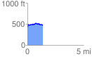
 1.358704 mi
 138.12 ft
 90.99 ft
 47.12 ft
 1.93 %
GPX Downloads: Track Route
![]()
|
| at: |
Bienville National Forest |
show on map
animate
1.358704 mi
138.12 ft
90.99 ft
47.12 ft
1.93 %