|
| at: |
Bienville National Forest |
Data from USFS GIS
 show on map
 animate
Trail users:


Elevation Profile
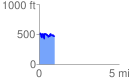
 0.982199 mi
 229.73 ft
 248.37 ft
 -18.64 ft
 4.79 %
GPX Downloads: Track Route
![]()
|
| at: |
Bienville National Forest |
show on map
animate
0.982199 mi
229.73 ft
248.37 ft
-18.64 ft
4.79 %