|
| at: |
Bienville National Forest |
Data from USFS GIS
 show on map
 animate
Trail users:


Elevation Profile
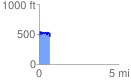
 0.680027 mi
 135.63 ft
 152.54 ft
 -16.91 ft
 4.25 %
GPX Downloads: Track Route
![]()
|
| at: |
Bienville National Forest |
show on map
animate
0.680027 mi
135.63 ft
152.54 ft
-16.91 ft
4.25 %