|
| at: |
Bienville National Forest |
Data from USFS GIS
 show on map
 animate
Trail users:


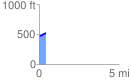
Elevation Profile
 0.412908 mi
 82.58 ft
 25.80 ft
 56.78 ft
 3.79 %
GPX Downloads: Track Route
![]()
|
| at: |
Bienville National Forest |
show on map
animate
0.412908 mi
82.58 ft
25.80 ft
56.78 ft
3.79 %