|
| at: |
DeSoto National Forest - Chickasawhay District |
Data from USFS GIS
 show on map
 animate
Trail users:


Elevation Profile
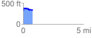
 0.804210 mi
 163.53 ft
 146.16 ft
 17.37 ft
 3.85 %
GPX Downloads: Track Route
![]()
|
| at: |
DeSoto National Forest - Chickasawhay District |
show on map
animate
0.804210 mi
163.53 ft
146.16 ft
17.37 ft
3.85 %