| at: |
DeSoto National Forest - Chickasawhay District |
Data from USFS GIS
 show on map
 animate
Trail users:


Elevation Profile
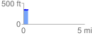
 0.397522 mi
 44.33 ft
 39.69 ft
 4.65 ft
 2.11 %
GPX Downloads: Track Route
![]()
| at: |
DeSoto National Forest - Chickasawhay District |
show on map
animate
0.397522 mi
44.33 ft
39.69 ft
4.65 ft
2.11 %