| at: |
DeSoto National Forest - Chickasawhay District |
Data from USFS GIS
 show on map
 animate
Trail users:


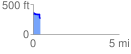
Elevation Profile
 0.427950 mi
 24.14 ft
 116.90 ft
 -92.75 ft
 5.17 %
GPX Downloads: Track Route
![]()
| at: |
DeSoto National Forest - Chickasawhay District |
show on map
animate
0.427950 mi
24.14 ft
116.90 ft
-92.75 ft
5.17 %