|
| at: |
DeSoto National Forest - Chickasawhay District |
Data from USFS GIS
 show on map
 animate
Trail users:


Elevation Profile
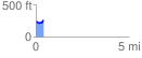
 0.417393 mi
 48.88 ft
 36.31 ft
 12.57 ft
 2.22 %
GPX Downloads: Track Route
![]()
|
| at: |
DeSoto National Forest - Chickasawhay District |
show on map
animate
0.417393 mi
48.88 ft
36.31 ft
12.57 ft
2.22 %