|
| at: |
DeSoto National Forest - Chickasawhay District |
Data from USFS GIS
 show on map
 animate
Trail users:


Elevation Profile
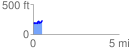
 0.532300 mi
 106.90 ft
 58.25 ft
 48.65 ft
 3.80 %
GPX Downloads: Track Route
![]()
|
| at: |
DeSoto National Forest - Chickasawhay District |
show on map
animate
0.532300 mi
106.90 ft
58.25 ft
48.65 ft
3.80 %