|
| at: |
DeSoto National Forest - Chickasawhay District |
Data from USFS GIS
 show on map
 animate
Trail users:


Elevation Profile
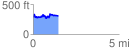
 1.481706 mi
 241.38 ft
 227.39 ft
 13.99 ft
 3.09 %
GPX Downloads: Track Route
![]()
|
| at: |
DeSoto National Forest - Chickasawhay District |
show on map
animate
1.481706 mi
241.38 ft
227.39 ft
13.99 ft
3.09 %