| at: |
DeSoto National Forest - South |
Data from USFS GIS
 show on map
 animate
Trail users:


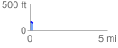
Elevation Profile
 0.212691 mi
 8.82 ft
 34.06 ft
 -25.25 ft
 3.03 %
GPX Downloads: Track Route
![]()
| at: |
DeSoto National Forest - South |
show on map
animate
0.212691 mi
8.82 ft
34.06 ft
-25.25 ft
3.03 %